Creating Spatially Complete Zoning Maps Using Machine Learning
Overview
Zoning regulates land use and the intensity of urban development at the county and municipal level throughout much of the United States. Beyond basic land use regulation, zoning is a tool that can be used to promote and manage economic growth, improve community health and livability, and protect the natural environment. Despite its importance, zoning data are limited in scale and availability, impairing regional-scale assessments of zoning regulations and coordinated efforts for resilience planning. In this study, we developed an open-source, replicable, and transferable framework to predict spatially continuous zoning districts. We applied a Hierarchical Random Forest algorithm to predict multilevel zoning districts including three core districts (residential, non-residential, mixed-use) and 13 sub districts.
How did we do it?
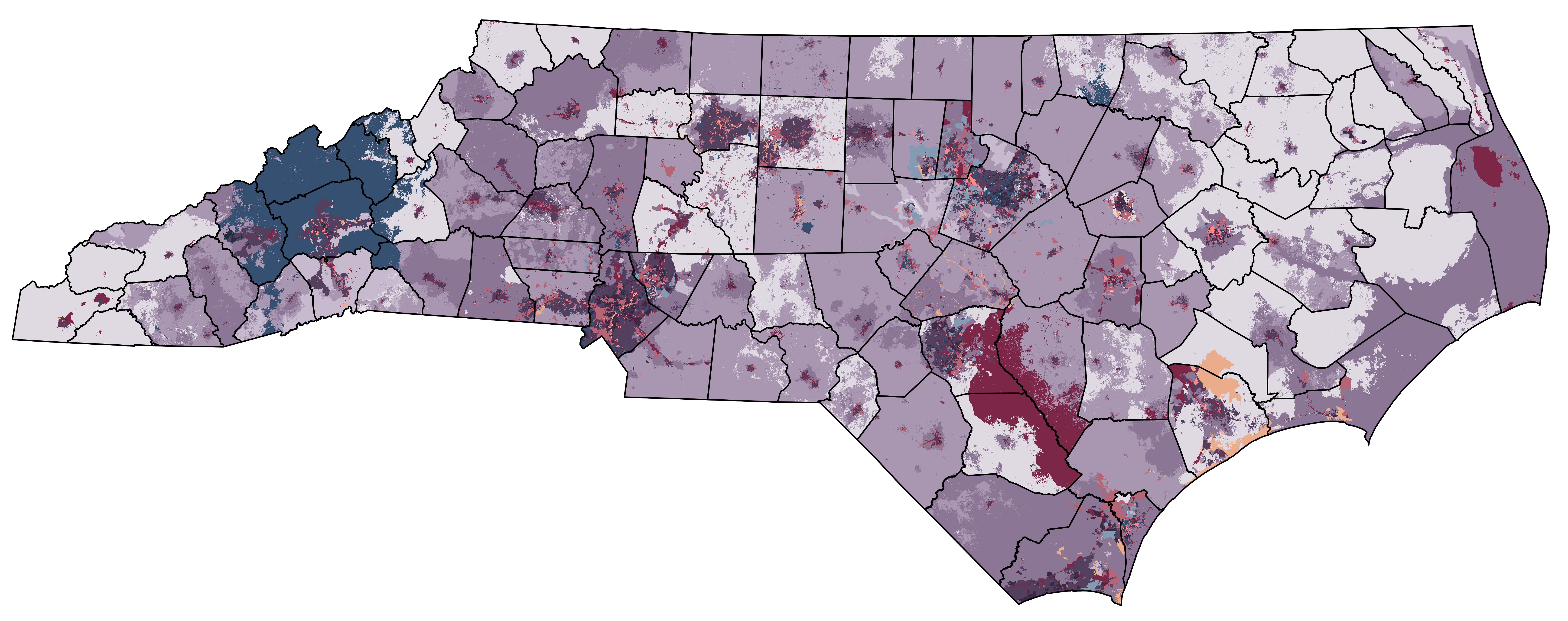
First, we gathered zoning data from parts of 39 counties of ~25% of the state of NC for training. Then, using a suite of ~40 predictors, we applied a machine learning (random forest) model to predict zoning in NC.
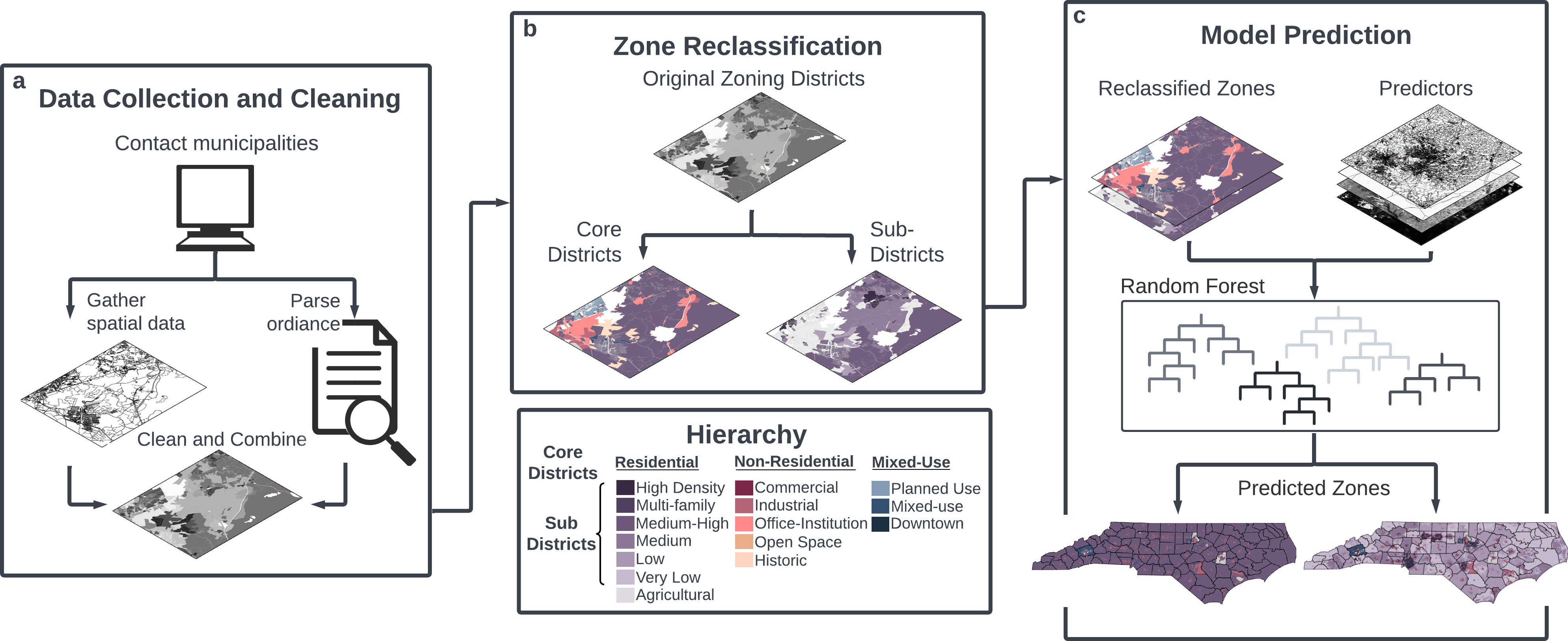
To mimic real-world data accessibility challenges, we evaluated two model implementations: one filling gaps within a county (within-county) and the other extrapolating for counties with no available data (between-county).
How did we do?
The within-county implementation showed strong performance (macro averaged F1 score of 0.97) regardless of district breakdown (i.e., core and sub). However, the model was unable to accurately extrapolate between counties resulting in poor performance for the sub-district between-county implementation (macro averaged F1 of 0.15) with slight improvement for core districts (macro averaged F1 of 0.27). This framework provides the foundation for future efforts in large-scale comprehensive zoning assessments.
Take a look!
Check out our results, framework, and manuscript