Zoning and Historical Development in North Carolina
Overview
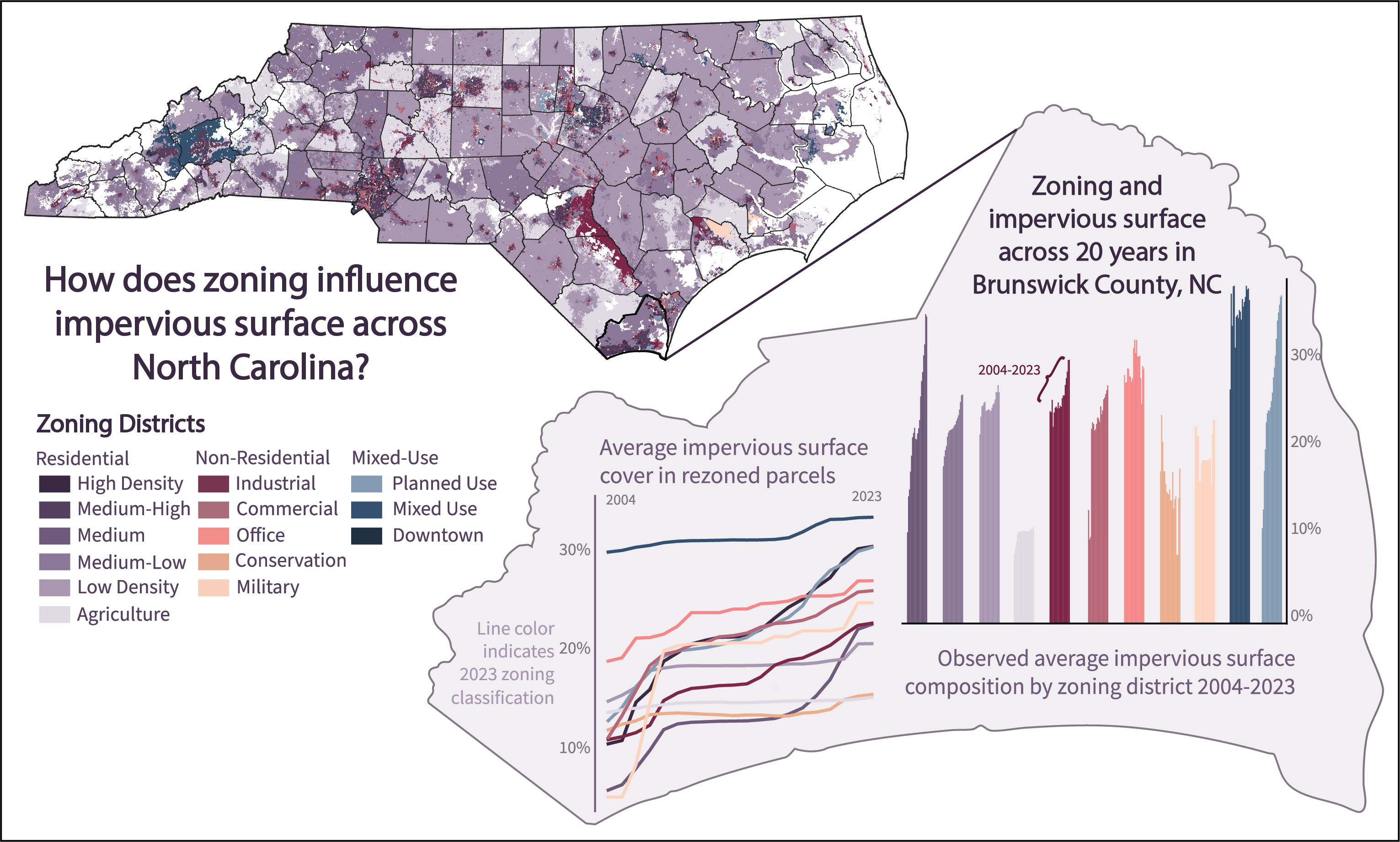
Zoning, a land-use policy tool, regulates the type, intensity, and location of development in over 95% of U.S. cities. Since its inception in 1916, zoning has been leveraged for wide-ranging objectives, from identifying conservation areas to improving human health. Despite century-long use, examinations of relationships between zoning and development outcomes in the U.S. have often had small spatial extent and/or disregarded rezonings (changes over time), preventing a generalizable understanding of zoning outcomes across regions. We address these limitations through a complementary, multi-scale approach that leverages two independent datasets; one prioritizing large spatial extent and the other offering temporal depth to overcome the common lack of temporal rezoning data at scale. For the large spatial extent dataset, we conduct a statewide cross-sectional analysis (2001–2023) of North Carolina relating zoning to impervious surface expansion, providing the first empirical assessment of 13 disaggregated zoning districts across a U.S. state. For temporal depth, we perform a local longitudinal analysis (2004–2023) that quantifies zoning–development relationships over two decades. Statewide and locally, Planned-Use districts experienced the largest growth, with urban development nearly tripling over 20 years, whereas Downtown, Parks and Recreation, and lower density Residential districts showed limited new development. Although effect directions were consistent across analyses, accounting for rezoning in the local case substantially reduced effect sizes, suggesting that static zoning designations alone may not fully capture development dynamics. By empirically quantifying zoning–development associations at multiple spatiotemporal scales, this study advances understanding of zoning outcomes and offers actionable insights for land-use policy, land-change science, and geospatial modeling.
This work was supported in part by an appointment to the Oak Ridge National Laboratory GRO Program, sponsored by the U.S. Department of Energy and administered by the Oak Ridge Institute for Science and Education and by funding provided by the North Carolina Sea Grant minigrant program.